Digital Matatus
2012-present
︎︎︎ Project Website
Project Leads
Sarah Williams
Jacqualine Klopp
Dan Orwa
Peter Waiganjo Wagacha
Research Assistants
Jonathan Campell
Lindewe Rennert
Wenfei Xu
Emily Eros
Alexis Howland
Catherine Vanderwart
Elizabeth Resor
Alicia Rouault
Rida Qadri
Steve Osoro
Carmelo Ignaccolo
Lily Bui
University of Nairobi Students
Support from
The Rockefeller Foundation
Google
World Bank
MIT International Policy Lab
︎︎︎ Project Website
Project Leads
Sarah Williams
Jacqualine Klopp
Dan Orwa
Peter Waiganjo Wagacha
Research Assistants
Jonathan Campell
Lindewe Rennert
Wenfei Xu
Emily Eros
Alexis Howland
Catherine Vanderwart
Elizabeth Resor
Alicia Rouault
Rida Qadri
Steve Osoro
Carmelo Ignaccolo
Lily Bui
University of Nairobi Students
Support from
The Rockefeller Foundation
World Bank
MIT International Policy Lab
Overview
“... the transit map had a powerful social impact -- for the first time everyone in Nairobi cold see it as one system ...”
A collaborative project of the University of Nairobi, Columbia University’s Center for Sustainable Urban Development, MIT’s Civic Data Design Lab, and Groupshot, Digital Matatus is collecting and standardizing transit data for Nairobi’s Matatus, the city’s decentralized bus system, making it available to the public for the first time.
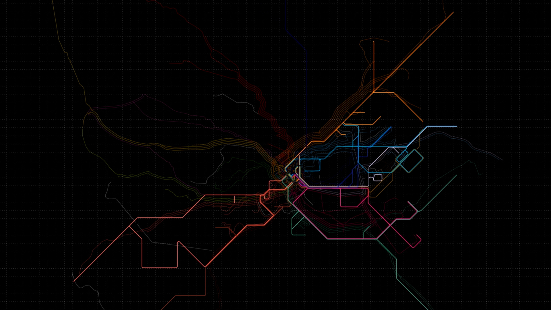
Digital Matatus has developed and deployed mobile phone apps to more efficiently collect location data of Nairobi’s Matatus. We have used the information gathered through this crowd-sourcing method to identify standardized bus routes now charted in city-wide maps that were released to the public in January of 2014. A new phase of the project will develop a phone application that allows us to update the Matatu route data.
 Congestion in Nairobi, Matatus make up the majority of vehicles on the roadway.
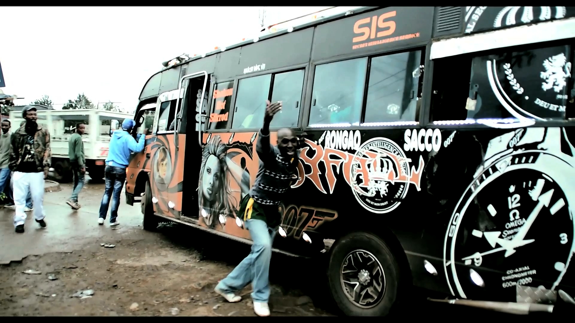 Matatus have set routes and stops set by the Matatu Owners Association.
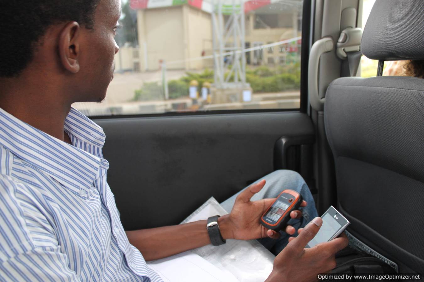 University of Nairobi students rode Matatus using an app to collect data.
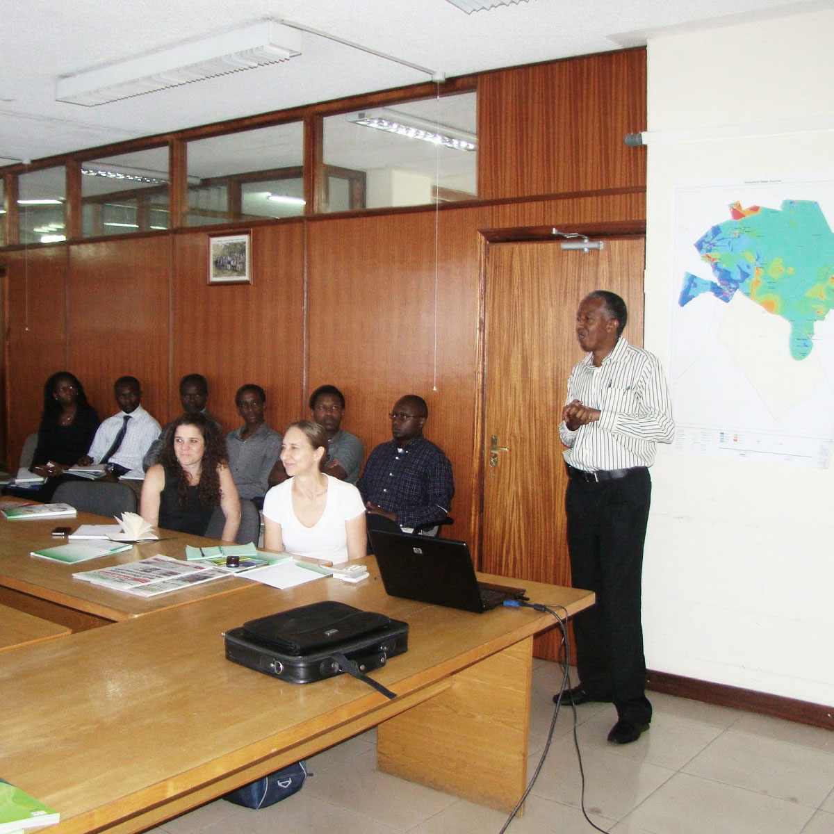 Workshops with key stakeholders to encourage their involvement.
Digital Matatus 3.0
Since the first release of Digital Matatus GTFS data in 2014, there have been two updates to the GTFS file. In the summer of 2018, the research team performed the third round of data collection. Two new tools were developed for this round of data collection. The first, Twiga Tatu, collected additional data about the condition of the Matatus. It should be noted that the first version of Twiga Tatu was developed by Lily Bui, Wenfei Xu, and Steve Osoro as part of the Crowd Sourced City course jointly taught with MIT and University of Nairobi Students.
The team also modified GTFS Editor an open source tool for editing GTFS data. The software was amended to allow a comparison of old routes to new routes and the ability to modify the old routes where needed, rather than developing a whole new GTFS file. There were many advantages to doing this, but perhaps the most important
is that it helped maintain the data in the format needed for Google Maps upload.
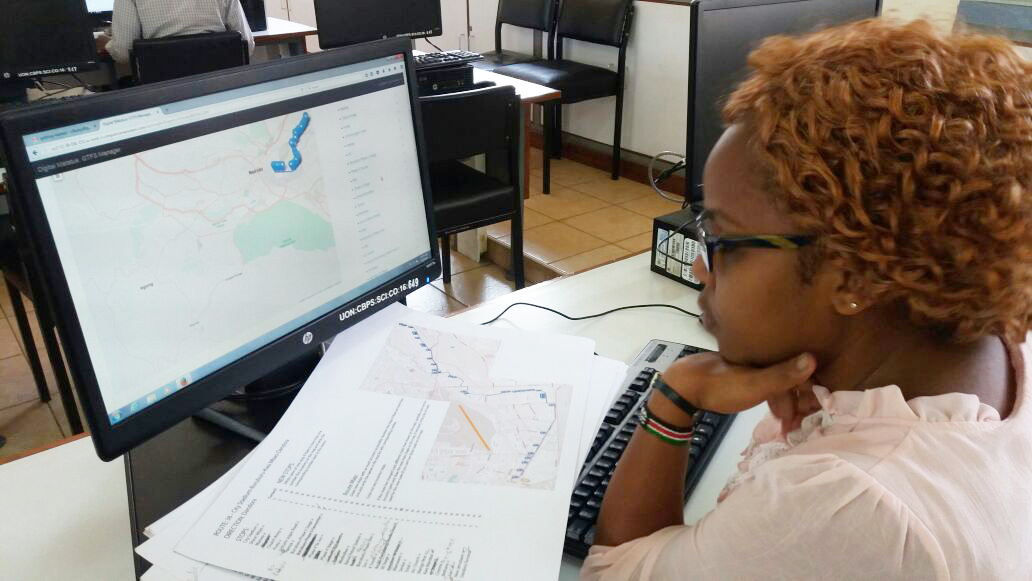 University of Nairobi students used a modified version of the GTFS editor to collect data.
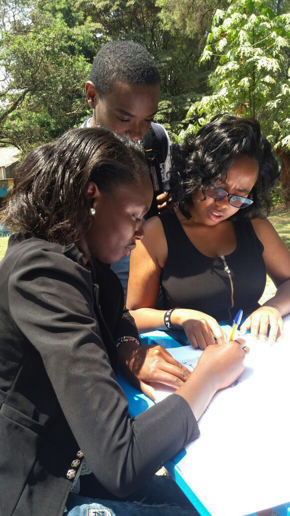 Students asked matatus drivers about changes to the routes.
Publications
Klopp, Jacqueline, Dan Orwa, Peter Waiganjo Wagacha, Sarah Williams, and Adam White. “Informal 2.0: Seeing and Improving Urban Informal Practices through Digital Technologies The Digital Matatus case in Nairobi.” Field Actions Science Reports. The journal of field actions Special Issue 16 (2017): 39-43.
Williams, Sarah, Adam White, Peter Waiganjo, Daniel Orwa, and Jacqueline Klopp. “The Digital Matatu Project: Using Cell Phones to Create an Open Source Data for Nairobi’s Semi-Formal Bus System.” Journal of Transport Geography 49 (2015): 39-51.
Williams, Sarah, Jacqueline Klopp, Peter Waiganjo, Daniel Orwa, Adam White. “Digital Matatus: Using Mobile Technology to Visualize Informality.” Proceedings ACSA 103rd Annual Meeting: The Expanding Periphery and the Migrating Center, (2015).
Klopp, Jacqueline, Sarah Williams, Peter Waiganjo, Dan Orwa and Adam White. “Leveraging Cellphones for Wayfinding and Journey Planning in Semi-Formal
Bus Systems: Lessons from Digital Matatus in Nairobi.” in Planning Support System and Smart Cities, Springer, (2015)
Press
︎︎︎ “8 Cities That Show You What The Future Will Look Like” WIRED, 2015
︎︎︎ “Nairobi Governor Launches Digital Matatus Project at the Ongoing City Lab London 2015 Conference.” CIO East Africa, Lilian Mutegi, November, 2015
︎︎︎ “Digital Matatus: Smartphones and Data Visualization to Report on Transport in Kenya.” Data Driven Journalism, November 19, 2015.
︎︎︎ “Digital Matatus.” BBC World Service Click Program, October 20, 2015.
︎︎︎ “How Tech is Making African Transit More Uber-like.” Fortune, David Z. Morris September 30, 2015.
︎︎︎ “In Praise of Matatus.” Economist, September 12, 2015.
︎︎︎ “Digital Matatus: An Educational Case Study.” National Geographic Magazine, September, 2015.
“How Nairobi Got Its Ad-Hoc Bus System on Google Maps.” Wired, August 26, 2015.
︎︎︎ “Map & App Help People Track Transit in Nairobi.” Earth Institute, August 26, 2015
︎︎︎“Digital Matatus Project Makes the Invisible Visible.” MIT News, August 26, 2015.
︎︎︎ “How We Mapped the Weirdest Streets.” Medium, February 12, 2015.
︎︎︎ “How Mobile is Transforming Passenger Transportation: Clearing the Way for More Livable Cities.” Economist Intelligence Unit (white paper), December 3, 2014.
︎︎︎ “Digital Matatus: Collaborative Research and Mapping for Nairobi’s Public Transit.” African Engineering News, November 29, 2014.
︎︎︎ “World’s Best Media Architecture Awarded.” Media Architecture Biennale 2014: World Cities, November 21, 2014.
︎︎︎ “Developing World Gets City Smart.” SciDev.Net, November 19, 2014.
︎︎︎ “The New Cartographers: How a Mapping Renaissance is Changing the Way We See Cities.” Next City, October 13, 2014.
︎︎︎ “Anson and Digital Matatus.” Mapping Amman, October 6, 2014.
︎︎︎ “Seeking Frugal Tech Solutions for Nairobi’s Jammed Traffic.” NPR, September 23, 2014. “How Data Improves the Daily Life in Nairobi.” Audi Urban Future Initiative, September 6, 2014.
︎︎︎ “Using Innovation and Creativity to Enhance Mobility in Semi-Urban Areas.” La Fabrique de la Cite, April 23, 2014.
︎︎︎ “New Maps and Open Data Pave Way for Nairobi BRT.” Institute for Transportation & Development Policy, March 7, 2014.
︎︎︎ “Cities in Motion: How We Mapped the Matatus of Nairobi.” The Guardian, February 19, 2014.
︎︎︎ “Digital Matatu Maps.” Timbuktu Chronicles, February 12, 2014.
︎︎︎ “These Digital Maps Could Revolutionize Nairobi’s Minibus Taxi System.” Next City, February 11, 2014 .
︎︎︎ “This Is What Informal Transit Looks Like When You Actually Map It.” The Atlantic Cities, February 3, 2014
︎︎︎ “Digital Matatus.” Dear Toto, January 31, 2014.
︎︎︎ “Nairobi Transit Map Launched.” The Star, Kenya, January 29, 2013.
︎︎︎ “Mapping Informal Transit Networks: ‘Imagine Not Knowing Where Any Bus
In Your City Goes.’” Joanna Mikulski’s Policy Design Blog, November 11, 2013.
Exhibitions & Awards
︎︎︎ Sustainia100, 2016
︎︎︎ IRU Global Bus Excellence Award for Research and Innovation, 2015.
︎︎︎ Urban Solutions to Global Challenges, CityLab, 2015.
︎︎︎ AFRICA Architecture, Culture and Identity, Louisiana Museum of Modern Art, Humlebæk, Denmark, 2015.
︎︎︎ Media Architecture Award for Participatory Architecture and Urban Interaction Media Architecture Biennale, 2014.
︎︎︎ Mapmaker Manifesto Curation, Istanbul Design Biennial, 2014.