September 11, 2017
The Ghost Cities project was introduced at the Seoul Biennale of Architecture and Urbanism as part of the “Commoning Cities” exhibition. The exhibition opened September 2nd at the Dongdaemun Design Plaza (DDP) in Seoul, and will continue until November 5th.
Directed by Hyungmin Pai and Alejandro Zaera-Polo, the Seoul Biennale of Architecture and Urbanism investigates the theme “imminent commons”, by proposing essential commons as a viable path for towards sustainable and just urbanism. The biennale is organized along the thematic exhibition, “Nine Commons”, which introduces the proposed commons, and the cities exhibition “Commoning Cities”, which presents questions and answers on the current and near future of cities.
![]()
In the “Communing Cities” section, the Ghost Cities project is introduced among 50 cities that report the most contemporary issues, policy directions and public projects. Municipal governments, academics, and practitioners are brought together in this exhibit to provide a discourse on strategies of cities on rapid urbanization, scarcity of public resources and privatization of commons in cities around the world.
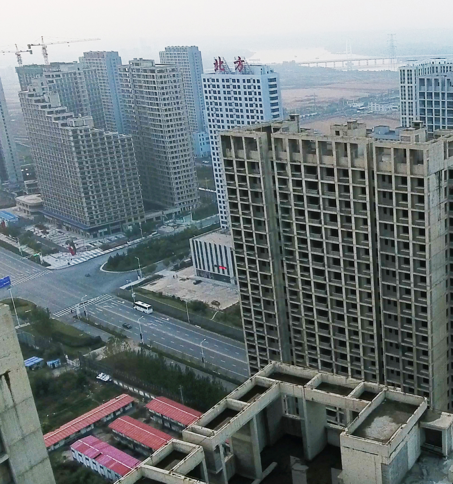
“Ghost Cities of China” presents the results of an analytical model that uses data scraped from Chinese social media sites to develop one of the first maps of the Ghost Cities phenomena in China. Using interactive screens and dramatic drone imagery, the exhibition immerses visitors in these vacant cities, which were vulnerable from overdevelopment as the Chinese economy slowed down.
![]()
![]()
Visitors entering the exhibition watch drone footage of Ghost Cities Shenyang, Tianjin and Chengdu, which were identified by the model. A video explains the data analysis process, including the novelty of scraping data from Chinese social media sites. Interviews with government officials, academics and developers tell the full story of policy and macro factors that created Ghost Cities. An interactive map allows visitors to browse through the cities we modeled and learn more about the characteristics of the vacant real estate developments.
The exhibition highlights the research project’s unique process of combining quantitative data models with qualitative data obtained through ground-truthing. Interviews with local government officials, real estate developers, local academics, and planners are coupled with data visualizations of the model results and drone imagery.
Directed by Hyungmin Pai and Alejandro Zaera-Polo, the Seoul Biennale of Architecture and Urbanism investigates the theme “imminent commons”, by proposing essential commons as a viable path for towards sustainable and just urbanism. The biennale is organized along the thematic exhibition, “Nine Commons”, which introduces the proposed commons, and the cities exhibition “Commoning Cities”, which presents questions and answers on the current and near future of cities.

In the “Communing Cities” section, the Ghost Cities project is introduced among 50 cities that report the most contemporary issues, policy directions and public projects. Municipal governments, academics, and practitioners are brought together in this exhibit to provide a discourse on strategies of cities on rapid urbanization, scarcity of public resources and privatization of commons in cities around the world.
“Ghost Cities of China” presents the results of an analytical model that uses data scraped from Chinese social media sites to develop one of the first maps of the Ghost Cities phenomena in China. Using interactive screens and dramatic drone imagery, the exhibition immerses visitors in these vacant cities, which were vulnerable from overdevelopment as the Chinese economy slowed down.


Visitors entering the exhibition watch drone footage of Ghost Cities Shenyang, Tianjin and Chengdu, which were identified by the model. A video explains the data analysis process, including the novelty of scraping data from Chinese social media sites. Interviews with government officials, academics and developers tell the full story of policy and macro factors that created Ghost Cities. An interactive map allows visitors to browse through the cities we modeled and learn more about the characteristics of the vacant real estate developments.
The exhibition highlights the research project’s unique process of combining quantitative data models with qualitative data obtained through ground-truthing. Interviews with local government officials, real estate developers, local academics, and planners are coupled with data visualizations of the model results and drone imagery.