September 9, 2015
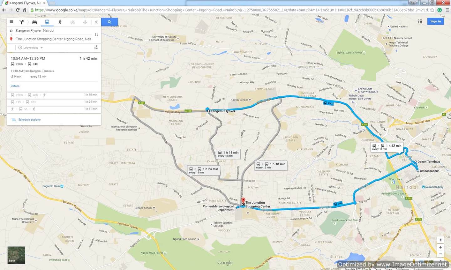
Users of Nairobi's infamous Matatu system now have a reason to celebrate. Much like transit users of many other cities in the world, they too can plan their journeys using Google Maps. On August 26, 2015 Google officially announced the launch of Digital Matatus's transit data on Google Maps.
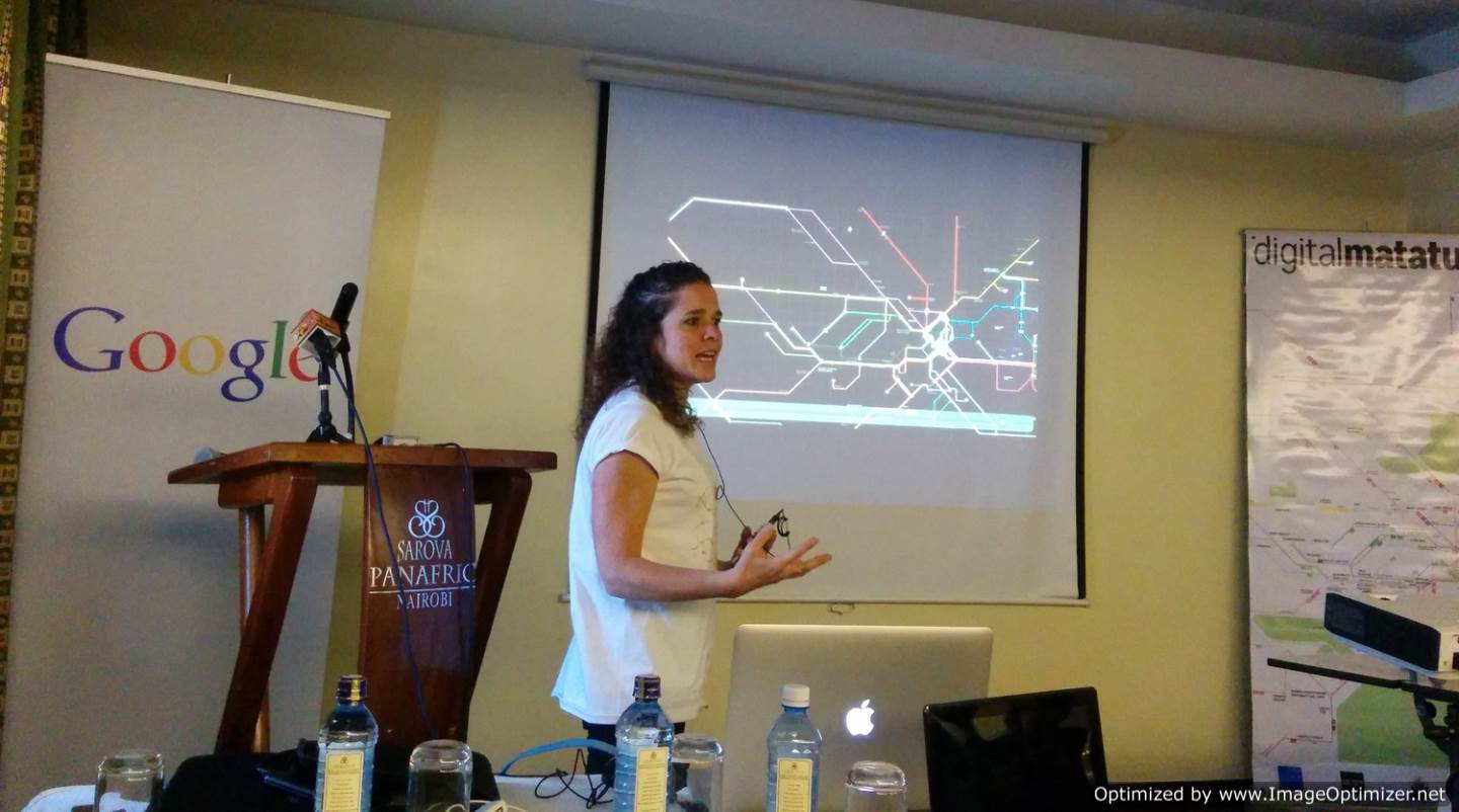
![Sarah Williams, Director of CDDL explains the creation of the Matatu Map at the launch]() Sarah Williams, Director of CDDL explains the creation of the Matatu Map at the launch
Sarah Williams, Director of CDDL explains the creation of the Matatu Map at the launch
This is the first time an informal transit system is navigable through Google Maps. For Nairobi's 3.8 million residents, this was an important step towards making their city more navigable and enhancing their mobility. The Digital Matatus team was overwhelmed by the buzz the project generated, with individuals coming up to them explaining how having this data on Google Maps was "life changing" for them.
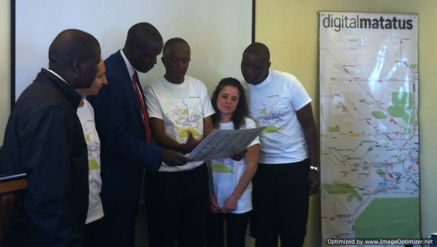
Among others, the launch was attended by Fernando Wangila, the deputy director of the ICT department at Nairobi's Transit Agency (NTSA).
![The Digital Matatus team shows the stylized map to Fernando Wangila, the deputy director of the ICT department at Nairobi's Transit Agency (NTSA).]() The Digital Matatus team shows the stylized map to Fernando Wangila, the deputy director of the ICT department at Nairobi's Transit Agency (NTSA).
The Digital Matatus team shows the stylized map to Fernando Wangila, the deputy director of the ICT department at Nairobi's Transit Agency (NTSA).
![The Digital Matatus Team with Evans Arubu of Google's Nairobi office]() The Digital Matatus Team with Evans Arubu of Google's Nairobi office
The Digital Matatus Team with Evans Arubu of Google's Nairobi office
To learn more about the Digital Matatus project, click here.
 Sarah Williams, Director of CDDL explains the creation of the Matatu Map at the launch
This is the first time an informal transit system is navigable through Google Maps. For Nairobi's 3.8 million residents, this was an important step towards making their city more navigable and enhancing their mobility. The Digital Matatus team was overwhelmed by the buzz the project generated, with individuals coming up to them explaining how having this data on Google Maps was "life changing" for them.
Among others, the launch was attended by Fernando Wangila, the deputy director of the ICT department at Nairobi's Transit Agency (NTSA).
 The Digital Matatus team shows the stylized map to Fernando Wangila, the deputy director of the ICT department at Nairobi's Transit Agency (NTSA).
 The Digital Matatus Team with Evans Arubu of Google's Nairobi office
To learn more about the Digital Matatus project, click here.